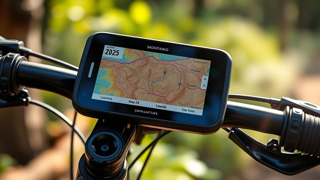
For MTB GPS computer mapping, the Garmin Edge MTB is my best overall pick for trail-focused riding, while the Garmin Edge Explore 2 suits riders who want broad route guidance and safety features. The iGPSPORT BiNavi offers a large touchscreen for map viewing, and the BSC300T brings offline map navigation to a smaller unit. The main tradeoffs are screen size, trail-ready durability, route detail, and how much setup you want to manage. Some computers emphasize mountain-bike ride data, while others are better at following routes across mixed terrain. Read on for the full breakdown and recommendations by rider type.

Get sports gear delivered free with Prime
- Fast, free delivery on millions of items
- Prime Video, Amazon Music and more included
- Member-only deals all year
Complete the kit


Key Takeaways
- The Garmin Edge MTB is the most trail-focused choice in this lineup, with the Edge MTB Bundle offering the same core appeal for riders who want a bundled setup.
- The Edge Explore 2 favors general navigation and safety features, making it a better match for mixed rides than a computer centered on mountain-bike metrics.
- The iGPSPORT BiNavi prioritizes map visibility with a 3.5-inch touchscreen, while the BSC300T pairs offline mapping with a more compact screen.
- COOSPO and GEOID options split the value-minded field: the CS600 and CC700 Pro add color touchscreens, while simpler models suit riders who need basic route guidance.
- Not every GPS computer here offers the same mapping depth; check offline map support, rerouting behavior, and route planning compatibility before buying.
| Garmin Edge Explore 2 GPS Cycling Navigator with Maps and Safety Features |  | Best for Easy, All-Round Navigation | Display: 3-inch high-resolution touchscreen | Mapping: Preloaded maps | Routing: eBike routing | VIEW ON AMAZON | See Our Full Breakdown |
| COOSPO CS600 Color Touchscreen GPS Bike Computer |  | Best for Long Battery Life | Screen: 2.4-inch color touchscreen | Positioning: GPS and GLONASS | Navigation: Route upload and breadcrumb trail | VIEW ON AMAZON | See Our Full Breakdown |
| iGPSPORT BiNavi 3.5-Inch Touchscreen GPS Bike Computer |  | Best for Rerouting and Climb Previews | Screen: 3.5-inch color touchscreen | Map type: Road | Navigation: Route imports, off-course rerouting, saved-location directions, and climb previews | VIEW ON AMAZON | See Our Full Breakdown |
| iGPSPORT BSC300T Wireless Bike Computer GPS with Touchscreen and Offline Map Navigation |  | Best for Offline Mapping Across Bike Types | Screen size: 2.4 inches | Navigation: Offline map download, route preview, turn prompts, and off-course warning | GPS support: GPS, BeiDou, GLONASS, Galileo, and QZSS | VIEW ON AMAZON | See Our Full Breakdown |
| Garmin Edge MTB Rugged GPS Bike Computer Bundle |  | Best for Dedicated Trail Navigation | Map type: Trail | Navigation: Preloaded Trailforks maps and Forksight trail navigation | Display: LCD with capacitive touchscreen | VIEW ON AMAZON | See Our Full Breakdown |
| GEOID CC700 Pro GPS Bike Computer with 2.8-Inch Color Touchscreen |  | Best for Connected Route Changes | Display: 2.8-inch color touchscreen | Storage: 4 GB | Navigation: Offline maps, turn prompts, and connected route recalculation | VIEW ON AMAZON | See Our Full Breakdown |
| iGPSPORT BSC500 GPS Bike Computer with 3.3-Inch Touchscreen and Voice Navigation |  | Best for Voice-Guided Navigation | Screen: 3.3-inch touchscreen | Controls: Touchscreen and buttons | Data display: Up to 12 cycling data points per page | VIEW ON AMAZON | See Our Full Breakdown |
| iGPSPORT BSC200S GPS Bike Computer with Wireless Route Navigation |  | Best for Long Days on the Trail | Screen: 2.4-inch semi-transflective color | Connectivity: Bluetooth and ANT+ | Battery: 600 mAh; up to 25 hours | VIEW ON AMAZON | See Our Full Breakdown |
| GEOID CC700 2.8″ Color Screen Bike Computer |  | Best for GPX Route Imports | Display: 2.8-inch color | Weight: 0.21 kg | Water resistance: IPX7 | VIEW ON AMAZON | See Our Full Breakdown |
| Garmin Edge MTB Rugged GPS Bike Computer |  | Best for Dedicated Trail Mapping | Display: 2.1-inch sunlight-readable color with Gorilla Glass | Maps: Trailforks and TopoActive preloaded | GPS: Multi-band GPS with 5 Hz recording | VIEW ON AMAZON | See Our Full Breakdown |
| COOSPO Wireless GPS Bike Computer with Bluetooth and ANT+ |  | Best Compact Mapping Pick | Display size: 2.4 inches | Display type: LCD | Positioning: GPS and Beidou | VIEW ON AMAZON | See Our Full Breakdown |
| mtb gps computer mapping | Connectivity | Navigation | Water resistance |
|---|---|---|---|
| Garmin Edge Explore 2 GPS Cycl | Bluetooth and smartphone pairing | — | — |
| COOSPO CS600 Color Touchscreen | Bluetooth and ANT+ | Route upload and breadcrumb trail | IPX7 |
| iGPSPORT BiNavi 3.5-Inch Touch | ANT, Bluetooth, and USB | Route imports, off-course rerouting, saved-location directions, and climb previews | IPX7 |
| iGPSPORT BSC300T Wireless Bike | ANT+ and Bluetooth 5.0 | Offline map download, route preview, turn prompts, and off-course warning | — |
| Garmin Edge MTB Rugged GPS Bik | — | Preloaded Trailforks maps and Forksight trail navigation | — |
| GEOID CC700 Pro GPS Bike Compu | Wi-Fi, ANT+, and Bluetooth | Offline maps, turn prompts, and connected route recalculation | IPX7 |
| iGPSPORT BSC500 GPS Bike Compu | — | Speed-adaptive turn alerts, automatic rerouting, and voice navigation | — |
| iGPSPORT BSC200S GPS Bike Comp | Bluetooth and ANT+ | — | IPX7 |
| GEOID CC700 2.8" Color Screen | ANT+, Bluetooth, and Wi-Fi | Turn-by-turn prompts, automatic rerouting, and GPX uploads via companion app | IPX7 |
| Garmin Edge MTB Rugged GPS Bik | Bluetooth and USB | — | — |
| COOSPO Wireless GPS Bike Compu | ANT+ and Bluetooth | — | IP67 |
More Details on Our Top Picks
Garmin Edge Explore 2 GPS Cycling Navigator with Maps and Safety Features
The Edge Explore 2 suits riders who want a large, straightforward map display for mixed cycling, including mountain bike rides that use mapped routes. Its 3-inch touchscreen gives route details more room than the COOSPO CS600’s 2.4-inch screen, which can make following a course easier at a glance. Preloaded maps and eBike routing also make it a flexible choice for riders who switch bikes or ride with an eBike. Safety tools such as incident detection and live tracking add useful support for solo outings, though some features depend on a paired phone. Compared with the Garmin Edge MTB, this model is less focused on trail-specific tools: it does not list Trailforks maps or Forksight navigation. Choose it for accessible mapping and broad compatibility; skip it if downhill and enduro tracking are your priority.
Pros:- Large 3-inch touchscreen gives maps and route details more viewing space than the smaller COOSPO CS600 display.
- Preloaded maps and multiple activity profiles support varied rides.
- Incident detection and live tracking add safety support for solo rides.
- Compatibility with eBikes, sensors, and Varia devices leaves room to expand.
Cons:- Some features rely on smartphone connectivity.
- Sensors and Varia devices are separate purchases.
- Lacks the named trail-specific mapping and descent tools of the Garmin Edge MTB.
Best for: Mountain and mixed-surface riders who want an easy-to-read mapped route display, eBike routing, and phone-linked safety features.
Not ideal for: Downhill and enduro riders who want Trailforks maps, Forksight trail details, or dedicated descent tracking.
- Display:3-inch high-resolution touchscreen
- Mapping:Preloaded maps
- Routing:eBike routing
- Connectivity:Bluetooth and smartphone pairing
- Compatibility:eBikes, smartphones, sensors, and Varia devices
- Safety features:Incident detection, smart notifications, and live tracking
Our verdict“Choose the Edge Explore 2 for approachable mapping across different bikes; choose the Garmin Edge MTB for more specialized trail navigation.”
COOSPO CS600 Color Touchscreen GPS Bike Computer
The COOSPO CS600 is a practical pick for riders who upload a route and follow a breadcrumb trail rather than needing detailed trail maps. GPS and GLONASS positioning, IPX7 water resistance, and up to 36 hours of stated battery life make it a compelling option for long rides. Its runtime exceeds the 14-hour figure listed for the Garmin Edge MTB, though that Garmin offers Trailforks maps and Forksight tools aimed specifically at mountain biking. The CS600’s 2.4-inch color touchscreen is smaller than the iGPSPORT BiNavi’s 3.5-inch display, so route details get less space. App syncing with COOSPORIDE, Strava, and TrainingPeaks broadens its usefulness after the ride. I’d pick it for straightforward route following and long outings, but not for riders who want richer off-course guidance or built-in trail detail.
Pros:- Up to 36 hours of stated battery life suits long rides between charges.
- GPS and GLONASS positioning support route tracking.
- IPX7 water resistance is suited to wet riding conditions.
- Syncs with COOSPORIDE, Strava, and TrainingPeaks.
Cons:- Breadcrumb guidance offers less map detail than the Garmin Edge MTB’s Trailforks and Forksight features.
- The 2.4-inch screen is smaller than the iGPSPORT BiNavi’s 3.5-inch display.
- Additional sensors and extension mounts are sold separately.
Best for: Riders who follow uploaded routes on long outings and value extended stated battery life, water resistance, and training-platform syncing.
Not ideal for: Mountain bikers who want trail-specific maps, automatic off-course rerouting, or a larger screen for map detail.
- Screen:2.4-inch color touchscreen
- Positioning:GPS and GLONASS
- Navigation:Route upload and breadcrumb trail
- Battery life:Up to 36 hours
- Water resistance:IPX7
- Connectivity:Bluetooth and ANT+
- Charging:USB Type-C
- App compatibility:COOSPORIDE, Strava, and TrainingPeaks
Our verdict“Choose the CS600 for long route-following rides and app syncing, but look to the Garmin Edge MTB for trail-specific navigation.”
iGPSPORT BiNavi 3.5-Inch Touchscreen GPS Bike Computer
For riders who want more than a line to follow, the iGPSPORT BiNavi combines route imports with automatic off-course rerouting, saved-location directions, and climb previews. That makes it better suited to exploring unfamiliar routes than the COOSPO CS600, whose navigation is described as breadcrumb guidance. Its 3.5-inch touchscreen is also the largest display specified among these five picks, giving map and climb information more room than the Edge Explore 2’s 3-inch screen. The tradeoff is a road map designation rather than named MTB trail mapping like the Garmin Edge MTB’s preloaded Trailforks maps. Some navigation features require the companion app, and music controls need a phone connection. I’d choose the BiNavi for riders who value rerouting and climb context; riders who mainly want dedicated downhill tools should look at the Garmin.
Pros:- Automatic off-course rerouting can help riders recover when they leave an imported route.
- Climb previews add terrain context before a major ascent.
- The 3.5-inch display is larger than the Edge Explore 2’s 3-inch touchscreen.
- Up to 35 hours of battery life and IPX7 water resistance suit extended rides.
Cons:- The listed map type is road, without the named Trailforks trail maps offered by the Garmin Edge MTB.
- Some navigation features require the companion app.
- Music controls require pairing with a phone.
Best for: Riders exploring unfamiliar routes who want a large touchscreen, off-course rerouting, and climb previews.
Not ideal for: Trail-focused enduro and downhill riders who want preloaded MTB trail maps and dedicated descent tracking.
- Screen:3.5-inch color touchscreen
- Map type:Road
- Navigation:Route imports, off-course rerouting, saved-location directions, and climb previews
- Satellite systems:GPS, BeiDou, GLONASS, Galileo, and QZSS
- Battery life:Up to 35 hours
- Water resistance:IPX7
- Connectivity:ANT, Bluetooth, and USB
- Memory:32 GB
Our verdict“Choose the BiNavi for rerouting and climb previews on exploratory rides; choose the Garmin Edge MTB for purpose-built trail details.”
iGPSPORT BSC300T Wireless Bike Computer GPS with Touchscreen and Offline Map Navigation
The BSC300T brings offline map downloads, route previews, turn prompts, and off-course warnings to riders who want mapped guidance without relying on a live connection throughout the ride. Its stated support for mountain bikes and e-bikes gives it broader bike-type appeal than the road-map-focused BiNavi, while multiple satellite systems support positioning across varied riding areas. The 2.4-inch touchscreen is compact beside the BiNavi’s 3.5-inch display, so map details may be harder to inspect quickly. The product data also leaves battery life unspecified, making it harder to judge for long backcountry outings. Setup may take more effort for beginners, and the app and device connection are part of the experience. I’d favor it for riders who value offline maps and bike flexibility, but choose the Garmin Edge MTB for specified trail-focused features.
Pros:- Offline map downloads support navigation without a live data connection.
- Route previews, turn prompts, and off-course warnings provide several forms of route guidance.
- Supports road, mountain, and e-bike use.
- GPS, BeiDou, GLONASS, Galileo, and QZSS are listed for positioning.
Cons:- The 2.4-inch display is smaller than the iGPSPORT BiNavi’s 3.5-inch screen.
- Battery life details are not specified in the supplied product data.
- Setup can be complex, with substantial reliance on app and device connectivity.
Best for: Mountain and e-bike riders who want downloadable offline maps, turn prompts, and route warnings across different bike types.
Not ideal for: Riders new to GPS computers who want simple setup, or remote-route riders who need clearly stated battery life before choosing.
- Screen size:2.4 inches
- Navigation:Offline map download, route preview, turn prompts, and off-course warning
- GPS support:GPS, BeiDou, GLONASS, Galileo, and QZSS
- Connectivity:ANT+ and Bluetooth 5.0
- Supported bikes:Road, mountain, and e-bike
- Data metrics:Speed, distance, grade, cadence, calories, time, and temperature
- Additional features:Real-time tracking and data sharing
Our verdict“Choose the BSC300T for offline mapping across bike types, provided its setup demands and unspecified battery life fit your rides.”
Garmin Edge MTB Rugged GPS Bike Computer Bundle
The Garmin Edge MTB is the clearest choice here for riders whose routes depend on trail forks, descents, and split times. Its preloaded Trailforks maps and Forksight navigation make it more trail-specific than the Edge Explore 2, while enduro and downhill profiles plus 5 Hz GPS recording add tools for tracking demanding runs. Seven buttons provide physical controls alongside the capacitive touchscreen, a useful setup when quick input matters on the trail. Its stated battery life is up to 14 hours, well below the COOSPO CS600’s up to 36 hours, so long days may call for more careful charge planning. The supplied bundle adds charging and cleaning accessories, but those do not change its proprietary operating system or narrower focus. I’d choose it for technical MTB use and skip it for general cycling routes.
Pros:- Preloaded Trailforks maps and Forksight show trail details and upcoming forks.
- Enduro and downhill profiles track descents and split times.
- 5 Hz GPS recording captures location data more frequently than standard lower-rate tracking.
- Seven buttons provide physical controls in addition to the capacitive touchscreen.
Cons:- Up to 14 hours of battery life is shorter than the COOSPO CS600’s stated up to 36 hours.
- The proprietary operating system may limit familiarity and flexibility.
- The bundle’s accessories add utility but do not expand its trail-focused mapping scope.
Best for: Enduro and downhill mountain bikers who want trail-specific mapping, fork guidance, and frequent GPS recording for split tracking.
Not ideal for: Riders prioritizing long battery life or general-purpose navigation across road and mixed cycling routes.
- Map type:Trail
- Navigation:Preloaded Trailforks maps and Forksight trail navigation
- Display:LCD with capacitive touchscreen
- Controls:7 buttons
- GPS recording rate:5 Hz
- Battery life:Up to 14 hours
- Mounting:Handlebar mount
- Included accessories:USB wall charger, 10-foot USB-A to USB-C cable, and 7-in-1 cleaning kit
Our verdict“Choose the Edge MTB for trail-specific navigation and descent data, but choose the CS600 if extended stated battery life matters more.”
GEOID CC700 Pro GPS Bike Computer with 2.8-Inch Color Touchscreen
The CC700 Pro suits mountain bikers who want offline maps on the device and the option to recalculate a route when a ride changes. Its 2.8-inch color touchscreen is larger than the Garmin Edge MTB’s 2.1-inch display, giving route prompts more room, while the Garmin is more specifically equipped for trail riding with preloaded Trailforks maps and MTB performance metrics. The Pro also adds Wi-Fi sync, smart-trainer support, and exports to STRAVA and TrainingPeaks, so it can serve for indoor sessions as well as outdoor navigation. The main mapping caveat is that recalculation needs a connection to its designated app; it is not a fully independent solution when you leave a planned route. Its DJI controls are also limited to Action 4 and Action 5 Pro cameras.
Pros:- Offline maps and turn prompts support navigation beyond a phone screen
- 2.8-inch color touchscreen pairs with button controls
- Wi-Fi, ANT+, and Bluetooth support device connections and syncing
- Smart-trainer support adds customizable power, resistance, and gradient workouts
Cons:- Route recalculation requires a connection to the designated app
- DJI camera controls work only with Action 4 and Action 5 Pro
Best for: Riders who want offline maps, a large screen, and app-connected route recalculation alongside indoor trainer support
Not ideal for: Riders who need route recalculation without a phone connection or prioritize purpose-built trail maps and MTB metrics
- Display:2.8-inch color touchscreen
- Storage:4 GB
- Navigation:Offline maps, turn prompts, and connected route recalculation
- Satellite systems:GPS, BeiDou, GLONASS, QZSS, and Galileo
- Connectivity:Wi-Fi, ANT+, and Bluetooth
- Water resistance:IPX7
- Indoor training:Smart-trainer support with customizable power, resistance, and gradient
- DJI compatibility:Action 4 and Action 5 Pro
Our verdict“Choose the CC700 Pro if you want a large mapped display and app-connected rerouting, and can accept that route changes depend on your phone.”
iGPSPORT BSC500 GPS Bike Computer with 3.3-Inch Touchscreen and Voice Navigation
For riders who would rather hear a turn cue than keep checking the handlebar, the BSC500’s voice navigation gives it a distinct role in this group. Its 3.3-inch touchscreen is larger than the GEOID CC700 Pro’s 2.8-inch screen, and the combination of touch and buttons offers more ways to interact while riding. It accepts routes from the iGPSPORT app, Strava, Komoot, and route files, with automatic rerouting and hill previews to help riders follow a course. That broad route support makes it a stronger fit for app-based planning than a basic data-focused computer, but the route workflow still depends on the app or a compatible route source. Unlike the BSC200S, the supplied details do not specify battery life or water resistance, so I would favor the smaller model when those ride-planning facts matter most.
Pros:- Voice navigation and speed-adaptive turn alerts reduce the need to watch the screen
- 3.3-inch touchscreen with button controls
- Imports routes from iGPSPORT, Strava, Komoot, and route files
- Dual-band L1/L5 positioning and multiple satellite systems
Cons:- Route planning relies on the iGPSPORT app or compatible route sources
- Battery life and water-resistance details are not provided
Best for: Riders who import routes from Strava or Komoot and want voice cues, rerouting, and a large display
Not ideal for: All-weather and long-distance riders who need confirmed water-resistance and battery-life specifications
- Screen:3.3-inch touchscreen
- Controls:Touchscreen and buttons
- Data display:Up to 12 cycling data points per page
- Positioning:Dual-band L1/L5; GPS, BeiDou, GLONASS, Galileo, and QZSS
- Route support:iGPSPORT app, Strava, Komoot, and route files
- Navigation:Speed-adaptive turn alerts, automatic rerouting, and voice navigation
- Additional features:Ride resumption, iClimb 2.0 hill previews, and training analysis
Our verdict“Pick the BSC500 if audible guidance and a large screen matter more to you than having documented battery and weather specifications.”
iGPSPORT BSC200S GPS Bike Computer with Wireless Route Navigation
The BSC200S is the practical pick for riders whose mapping needs sit alongside long hours in the saddle: it supports routes from Strava, Komoot, Ride with GPS, and the iGPSPORT app, and its stated up to 25-hour battery life is the clearest endurance figure among these five. Its 2.4-inch semi-transflective color screen is smaller than the BSC500’s 3.3-inch display, so route details have less space, but the sunlight-readable design and IPX7 rating suit exposed, wet rides. USB-C charging and storage for up to 400 hours of rides add convenience between outings. Compared with the GEOID CC700, this model has less detail provided about rerouting and mapping behavior; it also relies on the companion app for its full feature set, and radar and light connections are limited to iGPSPORT accessories.
Pros:- Up to 25 hours of stated battery life
- 2.4-inch color screen is designed for sunlight readability
- Route navigation supports Strava, Komoot, Ride with GPS, and the iGPSPORT app
- IPX7 water resistance and USB-C charging
Cons:- Full feature set depends on the iGPSPORT companion app
- Radar and light connectivity is limited to iGPSPORT-branded accessories
- Smaller screen offers less room for map detail than the BSC500
Best for: Bikepackers and endurance riders who want route imports, a sunlight-readable screen, and a stated long battery life
Not ideal for: Riders who want a large map display, detailed rerouting features, or compatibility with third-party radar and lights
- Screen:2.4-inch semi-transflective color
- Connectivity:Bluetooth and ANT+
- Battery:600 mAh; up to 25 hours
- Charging:USB Type-C; 1.5-hour charge time
- Water resistance:IPX7
- Data storage:Up to 400 hours of riding data
- Riding data:100+ metrics
- Compatible apps:iGPSPORT app, Strava, Ride with GPS, and Komoot
Our verdict“Choose the BSC200S for long rides and weather-ready route following if its smaller screen and app-dependent features suit your setup.”
GEOID CC700 2.8″ Color Screen Bike Computer
The GEOID CC700 gives riders a defined route-following setup: upload GPX files through its companion app, then use color turn-by-turn prompts and automatic rerouting. That makes it a natural choice for riders who already plan trails or routes elsewhere and want a larger handlebar display. Its 2.8-inch screen matches the CC700 Pro’s size, while ANT+, Bluetooth, and Wi-Fi support sensors and syncing with Strava and TrainingPeaks. The Pro pulls ahead if you want explicitly stated offline maps, 4 GB storage, or connected recalculation; this standard CC700’s listing emphasizes GPX uploads and auto-rerouting instead. Its five-satellite positioning and IPX7 rating are useful on varied rides, but battery life is unspecified, and the fastest positioning depends on Wi-Fi AGNSS sync every 14 days.
Pros:- GPX file uploads and automatic rerouting support route-based rides
- 2.8-inch color display shows turn prompts with room for data pages
- ANT+, Bluetooth, and Wi-Fi support sensors and syncing
- IPX7 water resistance and five satellite systems
Cons:- Battery life is not specified
- Fastest positioning requires Wi-Fi AGNSS sync every 14 days
- Requires the companion app for GPX uploads
Best for: Riders who plan routes as GPX files and want turn-by-turn guidance with broad sensor connectivity
Not ideal for: Riders who need a confirmed battery runtime or want the Pro model’s explicitly listed offline maps and storage
- Display:2.8-inch color
- Weight:0.21 kg
- Water resistance:IPX7
- Navigation:Turn-by-turn prompts, automatic rerouting, and GPX uploads via companion app
- Satellite systems:GPS, BeiDou, GLONASS, QZSS, and Galileo
- Connectivity:ANT+, Bluetooth, and Wi-Fi
- Sensor compatibility:Speed, cadence, and heart-rate sensors
- Data pages:108 data items
Our verdict“The CC700 fits riders who regularly follow imported GPX routes and value a large screen, provided the unspecified battery runtime is acceptable.”
Garmin Edge MTB Rugged GPS Bike Computer
The Garmin Edge MTB is the most trail-specific mapping choice here: Trailforks and TopoActive maps come preloaded, and Forksight guidance helps riders interpret trail junctions. That focus separates it from the GEOID CC700 Pro, which offers a larger display and app-connected route recalculation but does not list the same MTB-specific mapping and performance tools. Garmin’s 2.1-inch screen is the smallest of these five, so it gives up map viewing space; its compact 58 g body and seven-button controls suit rough riding where button operation can be easier than touch. Multi-band GPS with 5 Hz recording targets enduro and downhill tracking, while MTB metrics add context to a ride. The tradeoff is shorter stated runtime in demanding use, and some training functions need compatible sensors.
Pros:- Preloaded Trailforks and TopoActive maps with Forksight trail guidance
- Rugged 58 g design with scratch-resistant Gorilla Glass
- Multi-band GPS and 5 Hz recording for enduro and downhill rides
- MTB metrics include split times, jumps, Grit, and Flow
Cons:- 2.1-inch display is smaller than the GEOID CC700 models and iGPSPORT BSC500
- Up to 14 hours in demanding use is less than the BSC200S’s stated maximum
- Some training features require a compatible heart-rate monitor and power meter
Best for: Trail, enduro, and downhill riders who want preloaded MTB maps, trail guidance, and ride-specific performance metrics
Not ideal for: Riders who prioritize a large touchscreen or longer stated battery life for extended tours
- Display:2.1-inch sunlight-readable color with Gorilla Glass
- Maps:Trailforks and TopoActive preloaded
- GPS:Multi-band GPS with 5 Hz recording
- Battery life:Up to 14 hours; up to 26 hours in battery saver mode
- Controls:Seven-button design
- Sensors:Gyroscope, altimeter, accelerometer, magnetometer, and barometer
- Connectivity:Bluetooth and USB
- Weight:58 g
Our verdict“Choose the Edge MTB when preloaded trail maps and MTB-specific tracking matter more than a large display or extended battery runtime.”
COOSPO Wireless GPS Bike Computer with Bluetooth and ANT+
The COOSPO BC107 suits mountain bikers who want GPS-based route tracking in a small, light unit, with GPS and Beidou positioning for recording rides and app-based route mapping. Its 2.4-inch LCD keeps the device compact on the handlebar, but that smaller screen gives less room for reading map details than the iGPSPORT BSC300T or Garmin Edge Explore 2. Its ANT+ sensor support can add compatible ride data, while the stated Bluetooth connection supports app integration; the product information says sensors connect through ANT+, not Bluetooth. The IP67 rating is useful for wet and dusty trail conditions. The tradeoff is a simpler mapping setup than the larger touchscreen options, and some handlebar arrangements may need a separately purchased extension mount. I’d choose it for compact ride recording and basic route use, rather than map-heavy navigation.
Pros:- Compact, lightweight design takes up little handlebar space
- GPS and Beidou positioning support ride tracking
- ANT+ compatibility connects with supported sensors
- IP67-rated waterproof protection suits wet rides
Cons:- The 2.4-inch LCD offers less room for map details than larger-screen options
- Sensors connect via ANT+; Bluetooth sensor pairing is not supported
- An extension mount may need to be purchased separately for some setups
Best for: Mountain bikers who want a lightweight computer for GPS ride tracking and app-based route mapping, and who already use ANT+ sensors.
Not ideal for: Riders who need a large, detailed map display or Bluetooth sensor pairing; the smaller LCD and ANT+-only sensor compatibility may limit their setup.
- Display size:2.4 inches
- Display type:LCD
- Positioning:GPS and Beidou
- Connectivity:ANT+ and Bluetooth
- Mounting type:Handlebar mount
- Water resistance:IP67
- Battery type:Lithium-ion
- Weight:0.14 kg
Our verdict“Choose the COOSPO BC107 if compact GPS tracking and basic route mapping matter more to you than a large screen or Bluetooth sensor pairing.”

How We Picked
I ranked these computers around how useful their mapping is on mountain-bike rides: whether a rider can read the route on the bike, follow it without relying on a phone connection, and keep the device secure and usable on rough trails. Screen size, touch controls, offline map support, route guidance, and ruggedness all shaped the order. I also weighed how well each unit’s feature set fits its likely buyer, since a large navigation screen may matter more to an unfamiliar-route rider than a computer focused on ride data.
The Garmin Edge MTB takes the lead for its trail-oriented positioning, with the bundle close behind for riders who prefer a packaged setup. The Edge Explore 2 ranks highly for broad navigation and safety, while the larger iGPSPORT BiNavi earns a place for map legibility. The remaining models rank by the balance of mapping features, interface, and simplicity; basic wireless route guidance lands lower for riders who need detailed off-road maps. Product names and listed features guide this comparison, so I avoid claiming field-tested battery life, map accuracy, or durability.
Factors to Consider When Choosing Mtb Gps Computer Mapping
Choosing an MTB GPS computer means matching its mapping approach to the way you plan and ride. The following factors can help you avoid paying for navigation features you will rarely use—or buying a unit that leaves you guessing at a trail junction.
Check What “Mapping” Means on the Device
A route line on a blank background can guide a familiar loop, but it gives less context when trails split or connect unexpectedly. Full maps can show roads, paths, and nearby features, though map detail and availability vary by device and region. Look for clear information about offline maps if you ride beyond reliable phone coverage. Also check whether the computer follows a preloaded route, offers turn prompts, or can recalculate after a detour. Those functions are different, and product listings may use broad navigation language for all of them. Match the map type to how often you ride unfamiliar trails.
Choose Screen Size for Your Riding Position
A larger screen makes route lines and labels easier to scan, especially at junctions, but it can take up more handlebar space. A compact computer may fit a crowded cockpit and feel less intrusive on technical trails, yet small map labels can be harder to read at a glance. Touchscreens are convenient for panning or changing views, but gloves, moisture, and vibration can affect how comfortable they are to operate. Buttons can be easier to press without looking, though they may make map interaction less direct. Think about whether you mostly glance at the route while moving or inspect it during stops. Prioritize legibility without letting the display distract you from the trail.
Plan for No Signal and Route Changes
Mountain rides often pass through areas with weak mobile coverage, so a computer that stores maps and routes locally can be more dependable than one that depends on a connected phone. Offline storage does not automatically mean the unit can find a new route after a missed turn. Check whether it can reroute on-device, simply point back to the planned track, or requires you to stop and use a phone. Route preparation matters too: confirm that your planning service exports a format the computer accepts. A familiar loop may need only a breadcrumb line, while an exploratory ride benefits from stronger route context. Consider how much time you are willing to spend preparing maps before each trip.
Treat Ruggedness and Mounting as Part of Navigation
A map is useful only if the computer stays readable and attached over rough ground. Mountain-bike use exposes a device to vibration, mud, weather, and occasional impacts, so look for a secure mounting system and a body designed for outdoor riding. A bundled mount can make setup simpler, but verify that it fits your handlebar and riding position. Screen protection and button or touchscreen operation with gloves also affect day-to-day use. Avoid assuming that a model described as rugged has the same protection as another; compare the stated specifications. If you ride technical descents, a low-profile placement can reduce both snag risk and distraction.
Pay for the Navigation You Will Use
More screen area, offline maps, and richer navigation can make unfamiliar rides easier, but they add complexity alongside the benefits. Riders who follow known routes may be better served by straightforward wireless route guidance than by a larger mapping interface. Beginners often benefit most from readable directions and a simple route-loading process, rather than a long list of training metrics. Before paying for a premium feature set, check whether maps, route planning, or connected services require separate setup or subscriptions. Compare the computer’s supported sensors and phone connections only if those links are part of your routine. The best fit is the one that removes friction from your rides without adding menus you will ignore.
Frequently Asked Questions
Do I need offline maps for mountain biking?
Offline maps help when your routes pass through areas with weak mobile coverage or when you do not want navigation to depend on a phone connection. They are especially useful for unfamiliar trail networks where nearby paths provide context at junctions. A stored route line may still work without full maps, but it can offer less help when you need to understand where a detour leads. Check whether the specific computer stores map tiles locally and how those maps are added or updated. If you ride the same marked trails, a simpler route-following unit may be enough.
Is a larger touchscreen worth choosing for MTB mapping?
A larger touchscreen makes route lines and labels easier to see, which can reduce hesitation at confusing intersections. The tradeoff is a bigger device on the handlebar and potentially more interaction with the screen while riding. For technical trails, a quick glance matters more than being able to explore a map in detail mid-ride. Consider whether you usually stop to check directions or expect the computer to guide you continuously. If map legibility is your priority, the larger format of the BiNavi is a notable option in this lineup.
Can a basic GPS computer guide me on trails without detailed maps?
Yes, a device that follows a loaded route can keep you on a planned trail even when it does not show a rich background map. This works best when you prepare the route in advance and the trail network is familiar. At junctions or after a detour, a simple line gives less context than a map with nearby paths. Confirm whether the computer provides turn prompts and what it does when you leave the route. If you regularly explore new networks, map detail and rerouting support should carry more weight in your choice.
Should I choose a trail-specific computer or a general cycling navigator?
A trail-focused computer makes sense if mountain-bike ride information and a build suited to rough routes are your main priorities. A general cycling navigator may fit better if you also ride roads, need broad route guidance, or value safety features. The Garmin Edge MTB and Edge Explore 2 illustrate that difference in this roundup: one is positioned around MTB use, while the other emphasizes navigation across cycling routes. Compare how each handles the maps and route guidance you actually need, rather than choosing by category label alone. Riders who split time between trail and road may prefer the more versatile navigation approach.
What should I verify before buying a computer for unfamiliar trails?
Check that the unit can store routes or maps for offline use, and confirm how it responds when you miss a turn. Find out whether your route-planning app can export a compatible file and whether the device gives turn prompts or only displays a track. Screen readability and mount security matter because directions need to remain visible over rough ground. Also review regional map coverage; a feature name alone does not tell you how useful the maps are near your riding area. If those details are unclear in the product information, choose a model with explicitly listed offline mapping and route guidance.
Conclusion
For most mountain bikers prioritizing trail use, I recommend the Garmin Edge MTB as the best overall pick; choose the Edge MTB Bundle if its packaged setup suits your cockpit. The COOSPO CS600 or GEOID CC700 may suit value-minded riders who want a color display and route guidance, while the Edge Explore 2 is my best premium choice for riders who want broader navigation and safety features. Beginners should look at the iGPSPORT BSC300T for its offline map navigation, with the BSC200S as a simpler route-guidance alternative. For riders who value screen area above compactness, the iGPSPORT BiNavi stands out; compare its size and mapping capabilities with the smaller units before deciding.
Fall Picks
fall essentials
As an affiliate, we earn on qualifying purchases.